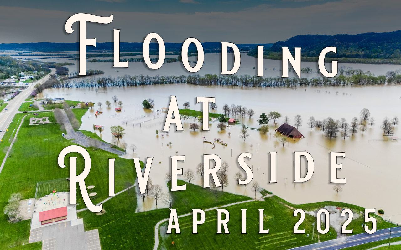
On April 7, 2025, we launched our drone above West Portsmouth, Ohio, to document the extent of flooding after several days of steady, soaking rain. From above, we followed the swollen Scioto River as it crept into Earl Thomas Conley Riverside Park, covering familiar paths and fields in muddy water.
As we flew, we took in more than just waterlogged views. Portsmouth West High School and its stadiums stood surrounded by rising water. Raven Rock State Nature Preserve appeared to cling to its higher ground. The bypass behind the old Scioto County Infirmary was clearly visible—carved out as a lifeline for travelers detouring around flooded Carey’s Run Road. From this height, we also traced the flow of US Route 52 both east and west, and turned our camera toward Portsmouth, catching glimpses of the former town of Alexandria and the historic site of a village—both stories written into this land long before we arrived.
Flooding like this is not new to the region. In fact, it’s what led to Alexandria’s eventual abandonment and the rise of Portsmouth as a safer settlement. Even Portsmouth, however, has not been immune, shaped again and again by floodwaters and its evolving network of levees and floodwalls.
There’s no narration in the video—just the quiet testimony of the land as it stands beneath the water. We invite you to join us from the air, to observe, to reflect, and to remember that the river always has a story to tell.